Land Registry Compliant Plans
What is a Land Registry Compliant Plan?
Land Registry Compliant Plans are accurate, scaled drawings that show the boundaries and layout of a property or land. Created to meet HM Land Registry’s strict requirements, these plans are essential for lease registrations, title splits, transfers, or resolving boundary disputes. They must include scale, orientation, and key measurements to ensure they are legally valid and accepted.

Why choose Sircle?
With years of experience in producing precise, legally compliant plans, Sircle ensures your documentation meets HM Land Registry requirements the first time—avoiding costly delays and rejections.
Our experienced team uses the latest surveying technology to create clear, accurate drawings tailored to your specific needs, whether for lease registration, title splits, or boundary clarification. As a RICS-registered firm, we adhere to the highest professional standards, giving you confidence in the quality and reliability of every plan we deliver.
Trust Sircle to get it right, first time—accurate, compliant, and hassle-free.
The Benefits of a Land Registry Compliant Plan
- Clear Legal Boundary Definition
Accurate drawings clearly define property boundaries, providing legal clarity and reducing ambiguity in ownership or access rights. - Successful Land Registry Submissions
Compliant plans meet all HM Land Registry requirements, helping to ensure your application is accepted without delay or rejection. - Essential for Property Transactions
These plans support key processes such as lease registrations, title splits, and property sales, forming a critical part of the legal documentation. - Reduces Risk of Disputes
Compliance plans help prevent boundary disputes and registration complications by clearly showing boundaries and measurements. - Recognised by Legal Authorities
Professionally prepared plans are accepted by solicitors, HM Land Registry, and other regulatory bodies, streamlining legal processes.
Sircle at Work
Examples of Land Registry Site Plans our team have created.
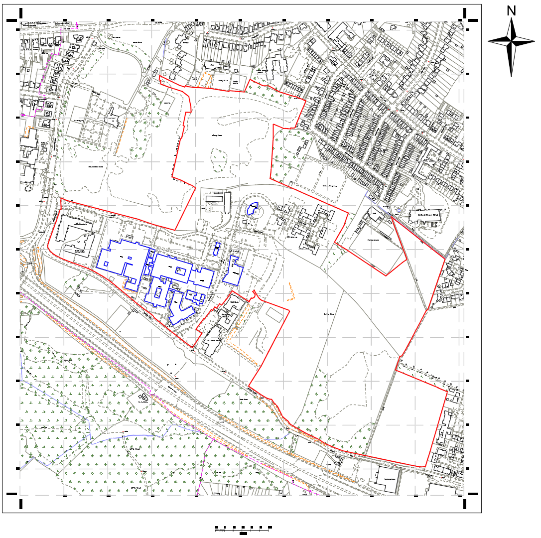
Land Registry Site Plan
Land Registry compliant site plan for an NHS Trust facility
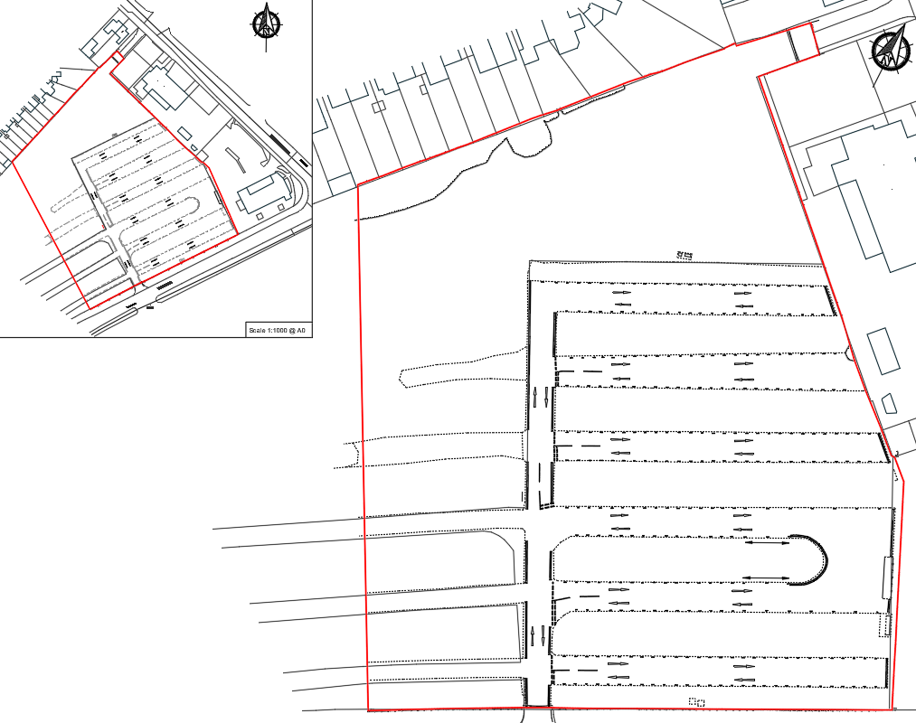
Land Registry Site Plan
Land Registry compliant site plan and lease plan for a car park