Topographical Survey
What is a Topographical Survey?
A topographical survey is a detailed and accurate representation of an area of land. It shows all the key features on site, including natural and artificial topographical features, such as ground levels and contours, building footprints, boundaries, trees, paths, fences, walls, etc.
It provides a clear picture of the site, so architects, engineers, planners, or developers can design or build with confidence. It’s often the first step before starting any kind of construction or development work because it helps to understand what’s already there and identify any potential issues early on.
Why choose Sircle?
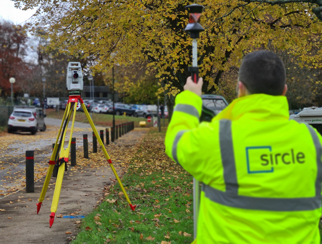
At Sircle, we use advanced equipment like GPS, Total Stations, 3D laser scanners, and drones to capture highly accurate data. This is turned into detailed CAD or Revit drawings to support planning, design, construction, and maintenance projects—right through to tender documents requiring precise area measurements.
With over 30 years of experience, our highly trained surveyors combine deep industry knowledge with the latest technology, including Point Cloud capture. The result? Clear, reliable outputs that support every stage of your project, from initial concept to final delivery.
The Benefits of a Topographical Survey
- Reduce Risk of Costly Design Changes
Accurate data on land levels and features helps your design team plan around the existing terrain—avoiding expensive revisions later on. - Get the Complete Picture of Your Site
When combined with drainage or utility surveys, a topographical survey gives you full visibility above and below ground—helping avoid service clashes, improving safety, and supporting smarter design and construction decisions. - Improve Budgeting and Tender Accuracy
Knowing the exact layout and measurements of your site helps define the scope of work clearly and leads to more accurate cost estimates and competitive tender pricing. - Strengthen Your Planning Application
A topographical survey provides reliable, verified site information that supports your planning submission and speeds up approvals..
Sircle at Work
Examples of recent Topographical Survey work our experienced team have carried out.
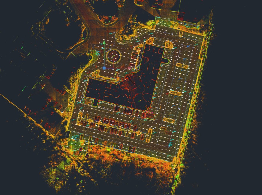
Topographical Survey Drawing
CAD drawing derived from Point Cloud data
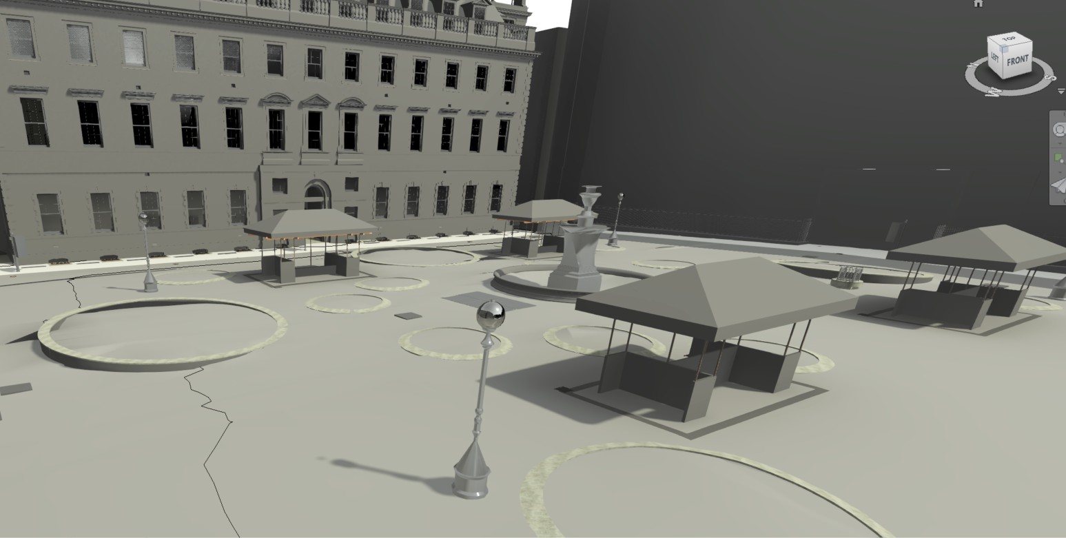
Topographical Revit Model
An example of a 3D topographical Revit model taken from a survey at an NHS Trust.

A Topographical Scan
Showing the building surroundings and ground levels.
Your questions answered
Why is a Topographical Survey Important?
At Sircle, we believe every successful project starts with a clear understanding of the site. A topographical survey is essential because it provides accurate, detailed information about the physical features and levels of the land. This includes boundaries, buildings, trees, utilities, and ground levels—critical data that informs design, planning, and construction decisions.
By commissioning a topographical survey early, we help reduce the risk of costly surprises later in the project. It ensures that architects, engineers, and planners are working with reliable information, which leads to more efficient design, smoother approvals, and fewer delays on-site.
Can a Topographical Survey be carried out in any weather?
Surveys can generally be conducted in most weather conditions, though extreme weather (heavy rain, snow, or strong winds) may cause delays or affect accuracy.