
Land Registry Compliant Plans
What is Swept Path Analysis?
Swept Path Analysis is a method used to simulate and assess how vehicles move through a site layout, including roads, access routes, parking areas, and construction zones. It helps determine the space required for different types of vehicles to turn, manoeuvre, and navigate safely—making sure there’s enough clearance to avoid collisions or obstructions.
This type of analysis is especially important when designing layouts that need to accommodate larger vehicles, such as lorries, buses, or emergency services. It ensures they can move through the site smoothly and safely, without causing operational issues or posing safety risks to people and structures.
Why choose Sircle?
At Sircle, we bring extensive experience in land and mapping surveys together with a clear understanding of real-world site constraints to deliver precise and reliable Swept Path Analysis. Having produced detailed topographical surveys and site plans across the UK for many years, our team knows the level of accuracy and planning insight required to support successful design and development.
Using advanced software to simulate vehicle movements, our Swept Path Analysis helps ensure your site layout complies with planning regulations, makes the best use of available space, and allows vehicles to manoeuvre safely and efficiently.
The Benefits of Swept Path Analysis
- Optimise Site Design
Swept Path Analysis helps refine layouts for car parks, access roads, and loading bays by ensuring vehicles can move safely and efficiently within the space. - Supports Planning Applications
It provides essential evidence to support planning submissions, showing compliance with local authority access and movement standards. - Prevents Costly Redesigns
By identifying turning and access issues early in the planning process, it reduces the risk of expensive changes during construction. - Maximises Use of Space
Especially valuable in tight urban environments, Swept Path Analysis helps ensure every square metre is used efficiently without compromising accessibility. - Improved Safety
The analysis highlights potential conflict points with pedestrians, structures, or other vehicles—helping to minimise collision risks and improve on-site safety.
Sircle at Work
Examples of Swept Path Analysis our team have completed
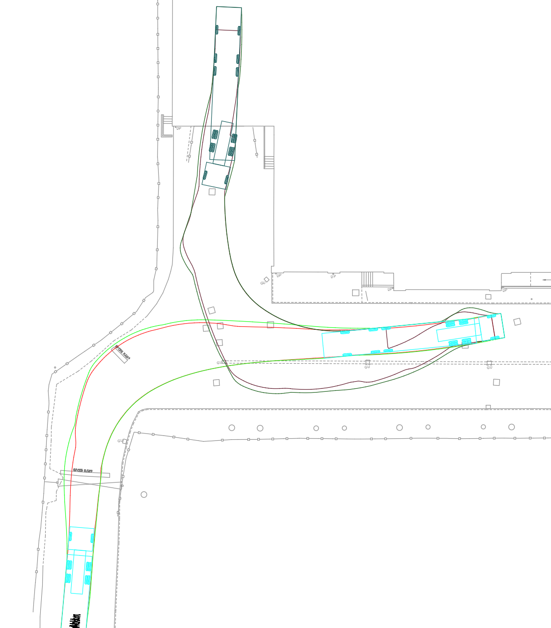
Swept Path Analysis
Vehicle turning routes for an industrial estate
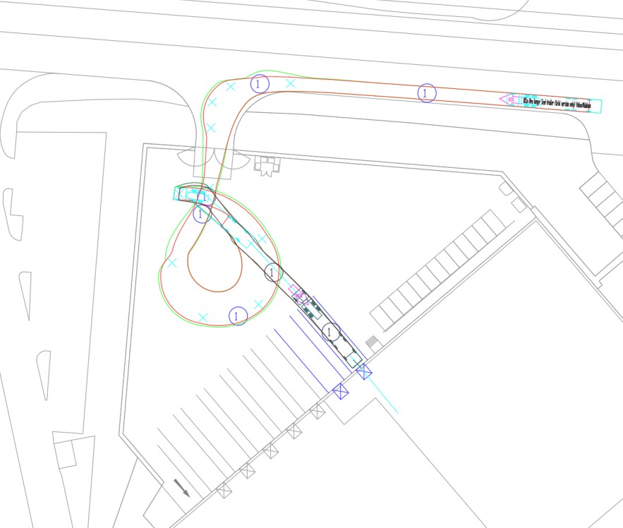
Swept Path Analysis
Swept path analysis for an industrial estate
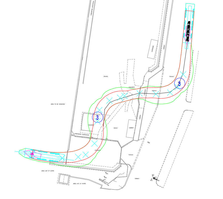
Swept Path Analysis
Vehicle turning routes for a public sector facility