Don’t Miss Out. CIF 2026/27 Expressions of Interest Are Now Open.
Expressions of interest for the next round of CIF (Condition Improvement Fund) Funding for 2025/26 are now open, with the…

A building elevation and section survey is conducted in order to produces detailed drawings of both the exterior façade and internal structure of a building.
Elevations show the external appearance, including height and architectural features, while sections reveal internal layouts like floor levels and ceiling heights. These surveys offer precise visuals to support accurate planning, design, and construction.
With over 30 years of industry experience, our skilled team of expert surveyors specialises in delivering precise elevation and section surveys tailored to the unique requirements of your project. By combining cutting-edge technology with tried-and-tested surveying methods, we ensure every detail is captured with accuracy and clarity.
Our comprehensive data sets support confident decision-making at every stage—from initial planning through to final execution—offering reliability you can trust throughout your project’s lifecycle.
Examples of building elevation surveys and drawings.
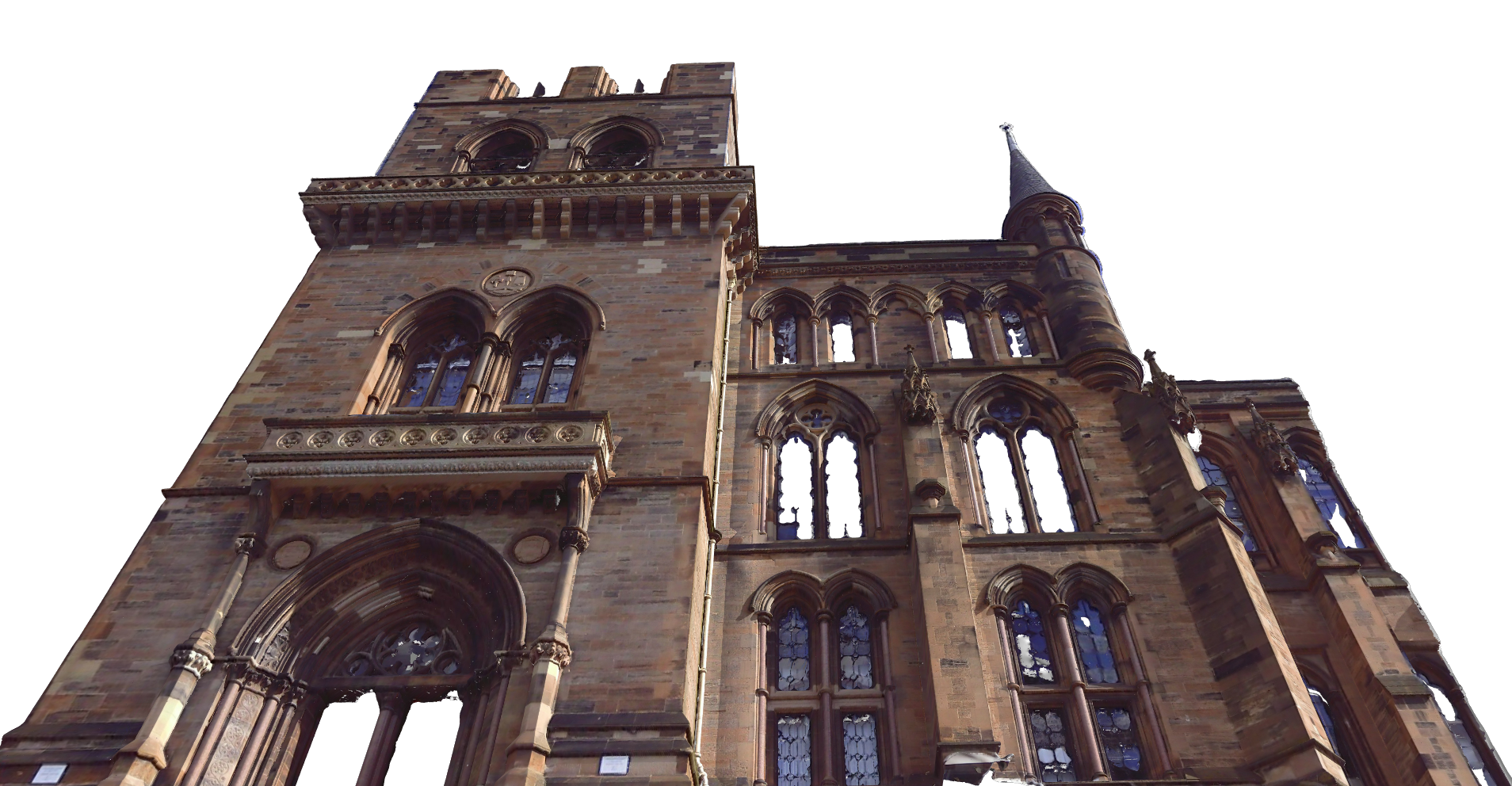
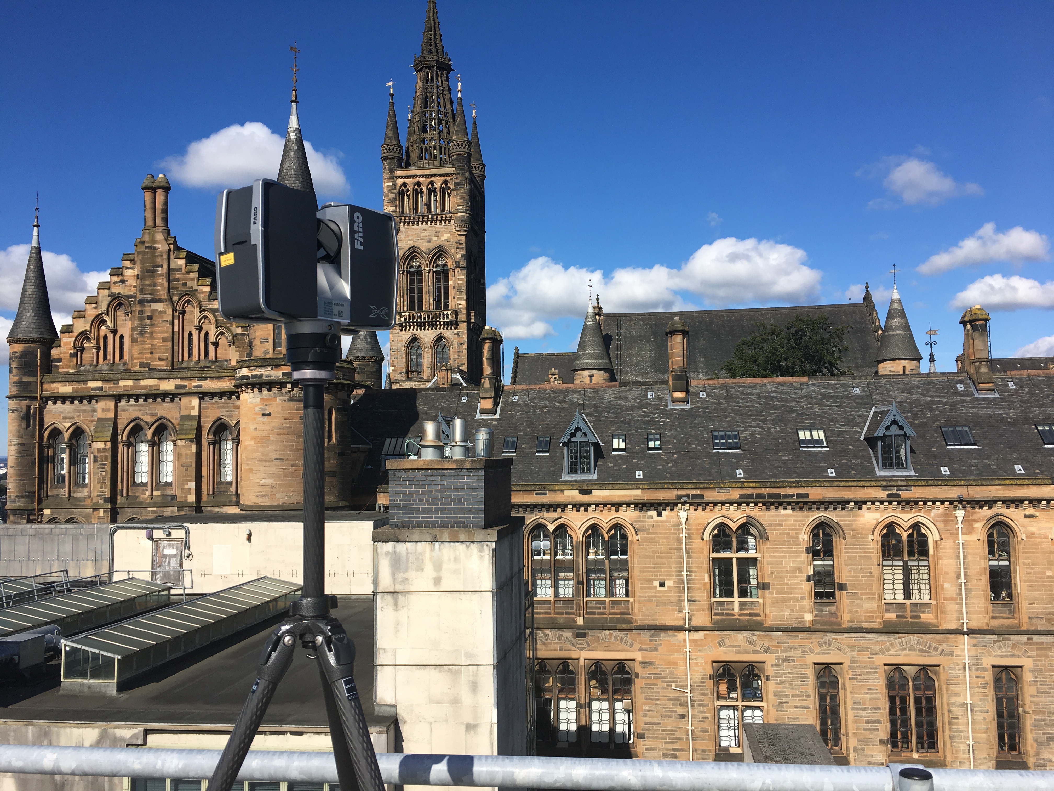
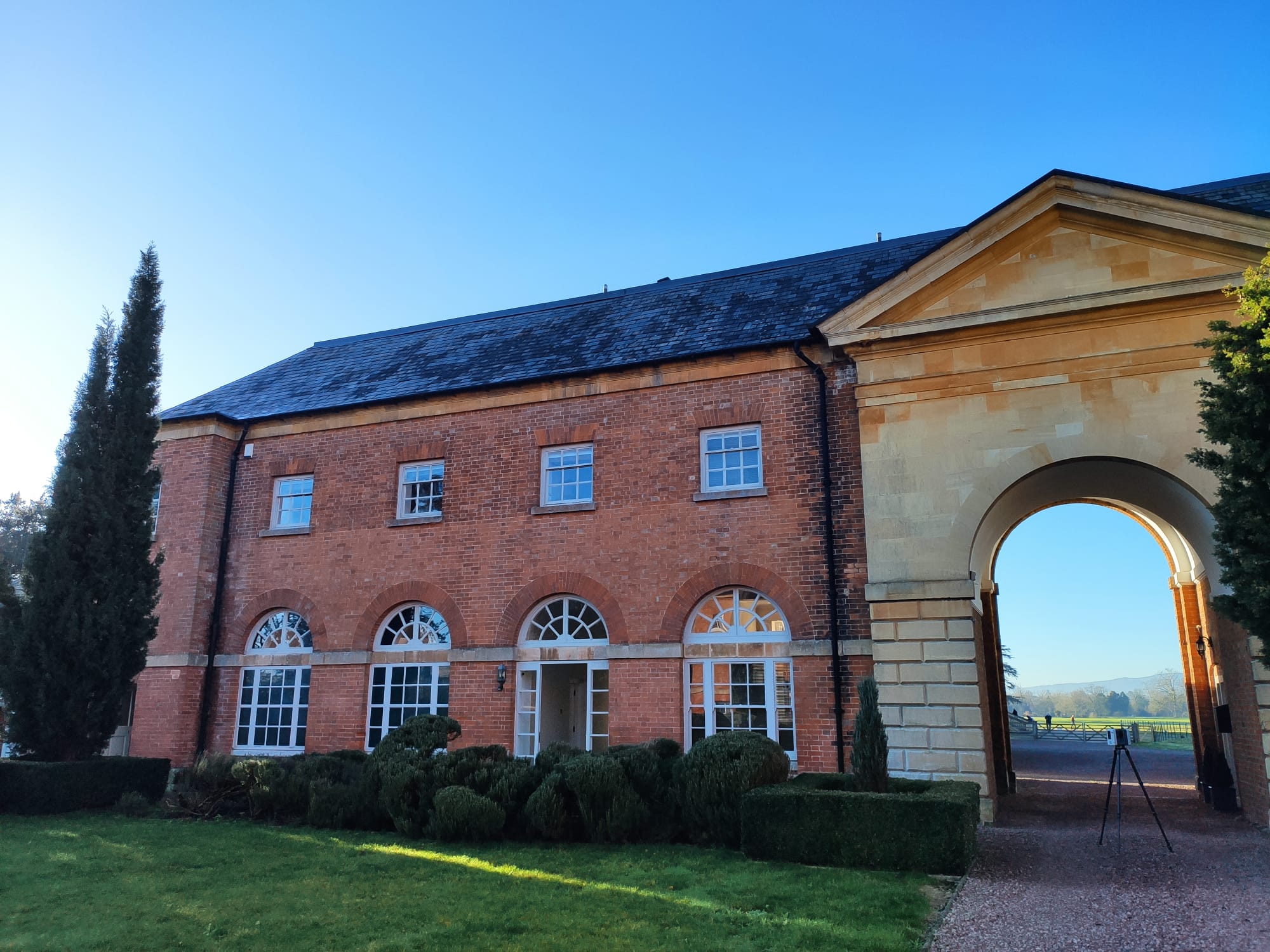
Point cloud survey captured to create detailed elevations of a historic building
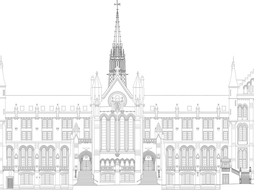
Elevation Drawing for University of Glasgow
High accuracy point cloud survey undertaken to capture detailed historic building facade details